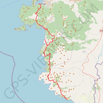
Voie lycienne - Fethiye-Kalkan
Randonnée pédestre. En aller simple. #Randonnée
- Distance: 47.8 mi
- Elevation gain: 5,207 m
- Maximum elevation: 805 m
- Elevation loss: 5,131 m
- Minimum elevation: 4 m
Interactive map
GPS track profile
About this GPS track
Name: Voie lycienne - Fethiye-Kalkan GPS track, route, trail
End: Gavurağılı, Pınarcık, Seydikemer, Muğla, Région Égéenne, 48360, Turquie (36.33004 29.21228)
Coordinates: 36.32998 29.08872 36.62164 29.21228
Other GPS tracks
Click on a GPS track to view route, its statistics and profile.