Sagamook Mountain - Mount Carleton
Interactive map
GPS track profile
About this GPS track
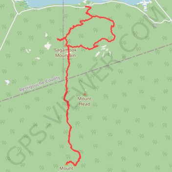
Name: Sagamook Mountain - Mount Carleton GPS track, route, trail
Start: Addington Parish, Restigouche County, New Brunswick, Canada (47.41827 -66.86865)
End: Addington Parish, Restigouche County, New Brunswick, Canada (47.41830 -66.86859)
Coordinates: 47.37744 -66.87939 47.41832 -66.85744
Other GPS tracks
Click on a GPS track to view route, its statistics and profile.