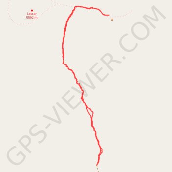
Lascar - Itinéraire Sud
Randonnée en aller-retour depuis Mesadas Romeros. #Randonnée
- Distance: 4.0 mi
- Elevation gain: 746 m
- Maximum elevation: 5,582 m
- Elevation loss: 745 m
- Minimum elevation: 4,859 m
- Moving time: 2 h 19 m
- Moving speed: 1.7 mph
- Maximum speed: 9.9 mph
- Total time: 3 h 6 m
- Global speed: 1.3 mph
- Date: 20/01/15
Interactive map
GPS track profile
About this GPS track
Name: Lascar - Itinéraire Sud GPS track, route, trail
Start: San Pedro de Atacama, Provincia de El Loa, Antofagasta, Chili (-23.38623 -67.72870)
End: San Pedro de Atacama, Provincia de El Loa, Antofagasta, Chili (-23.38619 -67.72871)
Coordinates: -23.38623 -67.73327 -23.36678 -67.72698
Other GPS tracks
Click on a GPS track to view route, its statistics and profile.
Paso-Cafayate
Chili > Antofagasta > Provincia de El Loa > San Pedro de Atacama
Vélo. En aller simple. #Vélo
Distance: 451.1 mi • Elevation gain: 6,696 m • Maximum elevation: 4,825 m