Moro jable - cofete
Randonnée depuis Pájara. #Randonnée
- Distance: 5.4 mi
- Elevation gain: 334 m
- Maximum elevation: 347 m
- Elevation loss: 385 m
- Minimum elevation: 8 m
- Moving time: 2 h 7 m
- Moving speed: 2.5 mph
- Maximum speed: 4.7 mph
- Total time: 2 h 27 m
- Global speed: 2.2 mph
- Date: 21/08/12
Interactive map
GPS track profile
About this GPS track
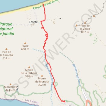
Name: Moro jable - cofete GPS track, route, trail
Coordinates: 28.05684 -14.38383 28.11235 -14.36822