Belvédère du domaine McGill
Interactive map
GPS track profile
About this GPS track
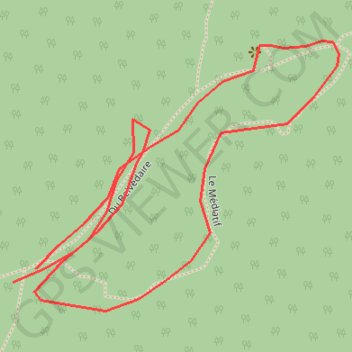
Name: Belvédère du domaine McGill GPS track, route, trail
Start: Du Belvédaire, Sainte-Julienne, Montcalm, Lanaudière, Québec, J0K 2T0, Canada (45.96942 -73.74905)
End: Du Belvédaire, Sainte-Julienne, Montcalm, Lanaudière, Québec, J0K 2T0, Canada (45.96931 -73.74933)
Coordinates: 45.96907 -73.74933 45.97131 -73.74545
Other GPS tracks
Click on a GPS track to view route, its statistics and profile.