Mount Lofty Loop
Yarra River. Warrandyte State Park. #Hike #Loop #Warrandyte
- Distance: 3.1 mi
- Elevation gain: 130 m
- Maximum elevation: 121 m
- Elevation loss: 130 m
- Minimum elevation: 51 m
- Moving time: 55 m 13 s
- Moving speed: 3.4 mph
- Maximum speed: 6.6 mph
- Total time: 55 m 13 s
- Global speed: 3.4 mph
- Date: 20/01/20
Interactive map
GPS track profile
About this GPS track
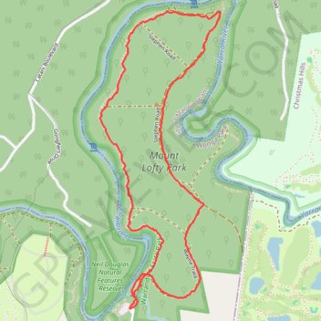
Name: Mount Lofty Loop GPS track, route, trail
Coordinates: -37.71832 145.28392 -37.70337 145.29157
Other GPS tracks
Click on a GPS track to view route, its statistics and profile.
Tallarook - Eildon - Hurstbridge
Australia > Victoria > Tallarook
#Bike
Distance: 173.2 mi • Elevation gain: 4,897 m • Maximum elevation: 868 m