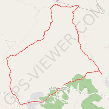
T2019-12-15-14-44
- Distance: 8.9 mi
- Elevation gain: 627 m
- Maximum elevation: 913 m
- Elevation loss: 627 m
- Minimum elevation: 529 m
- Moving time: 4 h 31 m
- Moving speed: 2.0 mph
- Maximum speed: 4.7 mph
- Total time: 5 h 31 m
- Global speed: 1.6 mph
- Date: 15/12/19
Interactive map
GPS track profile
About this GPS track
Name: T2019-12-15-14-44 GPS track, route, trail
Coordinates: 35.42860 -5.66808 35.46427 -5.62659
Other GPS tracks
Click on a GPS track to view route, its statistics and profile.
Maroc en boucle depuis Tanger
Maroc > pachalik de Tanger > Tanger
Distance: 1,882.0 mi • Elevation gain: 27,253 m • Maximum elevation: 2,301 m
TANGER BGHAGHZA 2019-12-15
Maroc > Cercle de Jebala دائرة جبالة > Bghaghza
Groupe IBN BATTOUTA RANDO - TINGIS RANDONNÉE PÉDESTRE TANGER 15 سوق الأحد البغاغزة الخرجة الميدانية # متعة المشي لاتضاهيها متعة #
Distance: 8.8 mi • Elevation gain: 624 m • Maximum elevation: 913 m