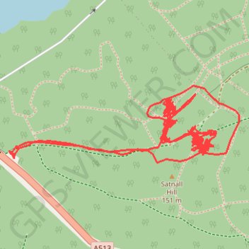
R SJ980210 2
- Distance: 2.5 mi
- Elevation gain: 93 m
- Maximum elevation: 149 m
- Elevation loss: 92 m
- Minimum elevation: 100 m
- Moving time: 1 h 24 m
- Moving speed: 1.8 mph
- Maximum speed: 4.3 mph
- Total time: 4 h 24 m
- Global speed: 0.6 mph
- Date: 28/05/21
Interactive map
GPS track profile
About this GPS track
Name: R SJ980210 2 GPS track, route, trail
Coordinates: 52.78634 -2.03595 52.78780 -2.02871
Topography: Staffordshire topographic map
Other GPS tracks
Click on a GPS track to view route, its statistics and profile.
RE SJ980210 1
United Kingdom > England > Staffordshire > Stafford > Milford > Milford
Distance: 2.4 mi • Elevation gain: 113 m • Maximum elevation: 149 m