Hollingbourne Hill Loop
- Distance: 19.5 mi
- Elevation gain: 390 m
- Maximum elevation: 198 m
- Elevation loss: 390 m
- Minimum elevation: 36 m
Interactive map
GPS track profile
About this GPS track
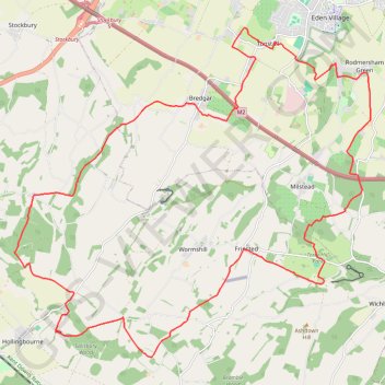
Name: Hollingbourne Hill Loop GPS track, route, trail
Coordinates: 51.26251 0.63895 51.32662 0.74965
Topography: Borough of Swale topographic map
Other GPS tracks
Click on a GPS track to view route, its statistics and profile.
High Wood Loop
United Kingdom > England > Kent > Borough of Swale > Rodmersham Green
Distance: 10.5 mi • Elevation gain: 196 m • Maximum elevation: 142 m
Bottom Pond Loop
United Kingdom > England > Kent > Borough of Swale > Rodmersham Green
Distance: 9.6 mi • Elevation gain: 227 m • Maximum elevation: 114 m