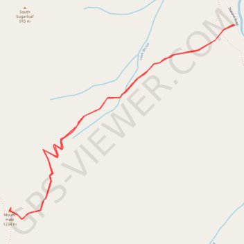
Mount Hale
Hike to Mount Hale via Hale Brook Trail in the White Mountain National Forest. #Hike #Mountain #Nature #Forest
- Distance: 4.2 mi
- Elevation gain: 679 m
- Maximum elevation: 1,224 m
- Elevation loss: 678 m
- Minimum elevation: 545 m
- Moving time: 2 h 15 m
- Moving speed: 1.9 mph
- Maximum speed: 3.2 mph
- Total time: 2 h 22 m
- Global speed: 1.8 mph
- Date: 29/08/23
Interactive map
GPS track profile
About this GPS track
Name: Mount Hale GPS track, route, trail
Coordinates: 44.22104 -71.51207 44.23645 -71.48709
Other GPS tracks
Click on a GPS track to view route, its statistics and profile.