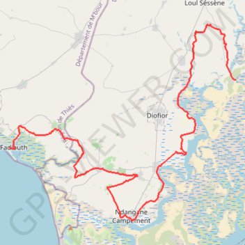
Raid Saloum Aventure-15084841
- Distance: 49.7 mi
- Elevation gain: 119 m
- Maximum elevation: 11 m
- Elevation loss: 121 m
- Minimum elevation: 0 m
- Moving time: 10 h 32 s
- Moving speed: 5.0 mph
- Maximum speed: 5.4 mph
- Total time: 10 h 32 s
- Global speed: 5.0 mph
- Date: 28/11/22
Interactive map
GPS track profile
About this GPS track
Name: Raid Saloum Aventure-15084841 GPS track, route, trail
Start: Fadiouth, Joal-Fadiouth, Département de M'bour, Thiès, 23015, Sénégal (14.15274 -16.82994)
Coordinates: 14.07271 -16.82994 14.28955 -16.57159
Other GPS tracks
Click on a GPS track to view route, its statistics and profile.
Route
Unknown Line Type
Distance: 49.7 mi • Elevation gain: 122 m • Maximum elevation: 11 m