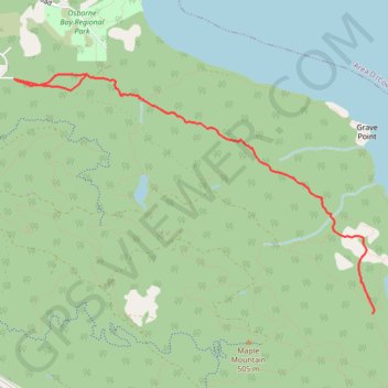
Osborne Bay Regional Park - Blue Trail
North Cowichan Municipal Forest Reserve. #Hike #Run #OsborneBay #NorthCowichan
- Distance: 5.4 mi
- Elevation gain: 433 m
- Maximum elevation: 246 m
- Elevation loss: 433 m
- Minimum elevation: 83 m
Interactive map
GPS track profile
About this GPS track
Name: Osborne Bay Regional Park - Blue Trail GPS track, route, trail
Coordinates: 48.83418 -123.63215 48.85195 -123.59170
Other GPS tracks
Click on a GPS track to view route, its statistics and profile.