Guadalupe Peak
Interactive map
GPS track profile
About this GPS track
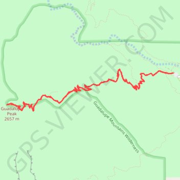
Name: Guadalupe Peak GPS track, route, trail
Start: Guadalupe Peak Trail, Culberson County, Texas, 79847, United States (31.89664 -104.82831)
End: Guadalupe Peak Trail, Culberson County, Texas, 79847, United States (31.89663 -104.82835)
Coordinates: 31.89016 -104.86167 31.89739 -104.82831