21/12/18 Solstice Walk
- Distance: 17.1 mi
- Elevation gain: 417 m
- Maximum elevation: 160 m
- Elevation loss: 416 m
- Minimum elevation: -2 m
- Moving time: 6 h 7 m
- Moving speed: 2.8 mph
- Maximum speed: 6.6 mph
- Total time: 8 h 26 m
- Global speed: 2.0 mph
- Date: 21/12/18
Interactive map
GPS track profile
About this GPS track
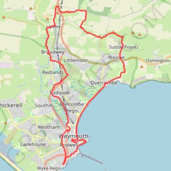
Name: 21/12/18 Solstice Walk GPS track, route, trail
Coordinates: 50.59573 -2.47536 50.67224 -2.41490
Other GPS tracks
Click on a GPS track to view route, its statistics and profile.
Tour d'Europe
France > Bretagne > Finistère > Concarneau > Landan Creis
Distance: 4,432.2 mi • Elevation gain: 44,603 m • Maximum elevation: 2,433 m
Tour de la petite Manche Angleterre
Royaume-Uni > Angleterre > Plymouth
Vélo. En aller simple entre Plymouth et Weymouth. #Vélo
Distance: 170.2 mi • Elevation gain: 4,094 m • Maximum elevation: 297 m