Breakneck Trails Loop
Interactive map
GPS track profile
About this GPS track
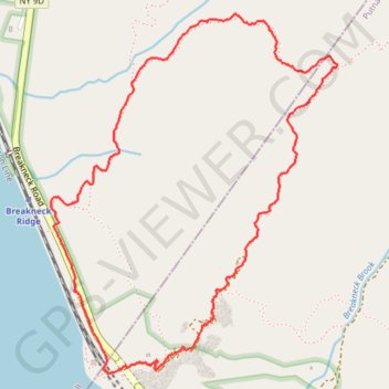
Name: Breakneck Trails Loop GPS track, route, trail
Coordinates: 41.44236 -73.98057 41.45583 -73.96623
Other GPS tracks
Click on a GPS track to view route, its statistics and profile.
Montréal - New York
Canada > Québec > Agglomération de Montréal > Montréal
Distance: 396.0 mi • Elevation gain: 4,134 m • Maximum elevation: 301 m