Vieux Fort
- Distance: 5.7 mi
- Elevation gain: 181 m
- Maximum elevation: 138 m
- Elevation loss: 180 m
- Minimum elevation: -1 m
Interactive map
GPS track profile
About this GPS track
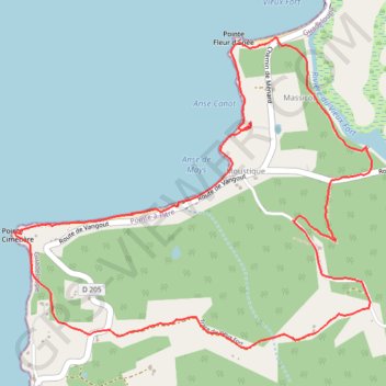
Name: Vieux Fort GPS track, route, trail
Coordinates: 15.96902 -61.31904 15.98710 -61.29744
Other GPS tracks
Click on a GPS track to view route, its statistics and profile.
Portsmooth-Anse Canot
Dominique > Saint John Parish > Portsmouth
Distance: 32.6 mi • Elevation gain: 0 m • Maximum elevation: 0 m