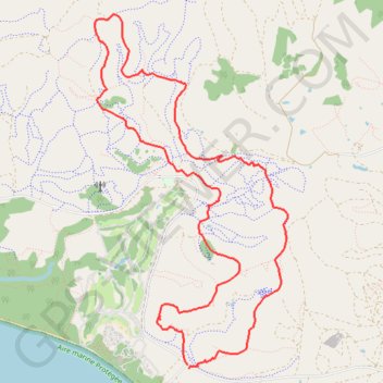
Carte Trek Erythrines
- Distance: 9.0 mi
- Elevation gain: 508 m
- Maximum elevation: 153 m
- Elevation loss: 506 m
- Minimum elevation: 12 m
Interactive map
GPS track profile
About this GPS track
Name: Carte Trek Erythrines GPS track, route, trail
Start: Piste de Déva, Bourail, Province Sud, Nouvelle-Calédonie, 98870, France (-21.60043 165.37248)
End: Piste de Déva, Bourail, Province Sud, Nouvelle-Calédonie, 98870, France (-21.60005 165.37230)
Coordinates: -21.60043 165.36160 -21.56235 165.38391
Other GPS tracks
Click on a GPS track to view route, its statistics and profile.