Island peak chukhung
File with points/tracks from Locus Map/4.11.1
- Distance: 7.4 mi
- Elevation gain: 720 m
- Maximum elevation: 6,124 m
- Elevation loss: 1,440 m
- Minimum elevation: 4,731 m
- Moving time: 2 h 52 m
- Moving speed: 2.6 mph
- Maximum speed: 3.8 mph
- Total time: 2 h 52 m
- Global speed: 2.6 mph
- Date: 27/09/22
Interactive map
GPS track profile
About this GPS track
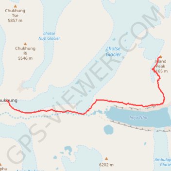
Name: Island peak chukhung GPS track, route, trail
Coordinates: 27.89951 86.87151 27.92059 86.93705