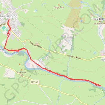
Grassington - River Wharfe
Walk along River Wharfe from Grassington. #Walk #Hike #River #Nature #Countryside #Forest
- Distance: 4.6 mi
- Elevation gain: 109 m
- Maximum elevation: 206 m
- Elevation loss: 109 m
- Minimum elevation: 153 m
- Moving time: 1 h 50 m
- Moving speed: 2.5 mph
- Maximum speed: 6.4 mph
- Total time: 2 h 4 m
- Global speed: 2.2 mph
- Date: 16/03/24
Interactive map
GPS track profile
About this GPS track
Name: Grassington - River Wharfe GPS track, route, trail
Start: Hardy Meadows, Grassington, North Yorkshire, England, BD23 5LR, United Kingdom (54.06922 -1.99766)
End: Hardy Meadows, Grassington, North Yorkshire, England, BD23 5LR, United Kingdom (54.06924 -1.99787)
Coordinates: 54.05804 -1.99955 54.07234 -1.96432
Topography: North Yorkshire topographic map