Cascades Gras et Tambour
- Distance: 2.1 mi
- Elevation gain: 117 m
- Maximum elevation: 262 m
- Elevation loss: 43 m
- Minimum elevation: 154 m
Interactive map
GPS track profile
About this GPS track
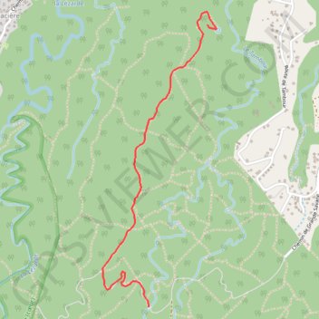
Name: Cascades Gras et Tambour GPS track, route, trail
Coordinates: 16.15664 -61.65317 16.17608 -61.64538
Other GPS tracks
Click on a GPS track to view route, its statistics and profile.
45 Km
France > Guadeloupe > Lamentin > Crâne
Distance: 28.5 mi • Elevation gain: 834 m • Maximum elevation: 266 m