Import a GPX file

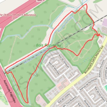
Promenade au parc de Laval

Randonnée en boucle depuis Laval. #Randonnée #Boucle

  • Distance: 2.6 mi
  • Elevation gain: 23 m
  • Maximum elevation: 37 m
  • Elevation loss: 21 m
  • Minimum elevation: 18 m
  • Moving time: 53 m 4 s
  • Moving speed: 3.0 mph
  • Maximum speed: 11.7 mph
  • Total time: 56 m 37 s
  • Global speed: 2.8 mph
  • Date: 06/10/11

Interactive map

GPS track profile

About this GPS track

Other GPS tracks

Click on a GPS track to view route, its statistics and profile.

Québec - Montréal - Saint-Laurent River - Lake Ontario - Niagara Falls

Canada > Quebec > Urban agglomeration of Québec > Quebec

#Bike #Ontario

Distance: 670.1 mi • Elevation gain: 4,804 m • Maximum elevation: 209 m

Grenville-sur-la-Rouge - Montréal

Canada > Quebec > Argenteuil > Grenville-sur-la-Rouge

Ottawa River. #Bike #Montréal

Distance: 77.8 mi • Elevation gain: 531 m • Maximum elevation: 92 m