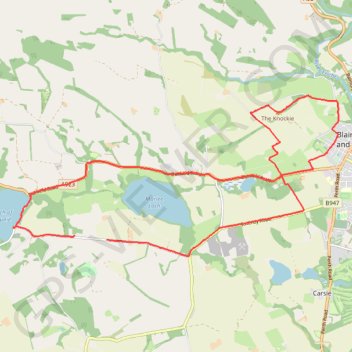
The Knockie, Marlee Loch and Loch of Clunie Loop
Loop MTB / run / hike around Blairgowrie via The Knockie, Marlee Loch and Loch of Clunie. #Hike #Loop #Nature #Countryside #Lake
- Distance: 10.7 mi
- Elevation gain: 271 m
- Maximum elevation: 203 m
- Elevation loss: 282 m
- Minimum elevation: 49 m
- Moving time: 1 h 6 m
- Moving speed: 9.6 mph
- Maximum speed: 28.7 mph
- Total time: 1 h 7 m
- Global speed: 9.5 mph
- Date: 02/03/24
Interactive map
GPS track profile
About this GPS track
Name: The Knockie, Marlee Loch and Loch of Clunie Loop GPS track, route, trail
Start: Craigie, Perth and Kinross, Scotland, PH10 6RD, United Kingdom (56.57635 -3.41277)
Coordinates: 56.57362 -3.44044 56.59981 -3.34424
Topography: Perth and Kinross topographic map
Other GPS tracks
Click on a GPS track to view route, its statistics and profile.