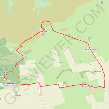
Craigowl Hill Loop
Loop run / hike from Balkello Community Woodland to Craigowl Hill. #Run #Hike #Loop #Nature #Forest #Countryside
- Distance: 5.8 mi
- Elevation gain: 310 m
- Maximum elevation: 451 m
- Elevation loss: 310 m
- Minimum elevation: 153 m
- Moving time: 1 h 2 m
- Moving speed: 5.5 mph
- Maximum speed: 17.4 mph
- Total time: 1 h 19 m
- Global speed: 4.3 mph
- Date: 01/03/24
Interactive map
GPS track profile
About this GPS track
Name: Craigowl Hill Loop GPS track, route, trail
Coordinates: 56.53164 -3.03471 56.54998 -2.98456
Topography: Angus topographic map