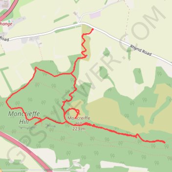
Moncrieffe Hill
eMTB Gravel: Tay Car Park -> Moredun Top Hillfort - Loop (Geocaching) #UK #Perthshire #Perth #Bike #Nature #Forest #Countryside
- Distance: 4.8 mi
- Elevation gain: 223 m
- Maximum elevation: 219 m
- Elevation loss: 223 m
- Minimum elevation: 76 m
- Moving time: 55 m 30 s
- Moving speed: 5.2 mph
- Maximum speed: 13.6 mph
- Total time: 1 h 33 m
- Global speed: 3.1 mph
- Date: 10/02/24
Interactive map
GPS track profile
About this GPS track
Name: Moncrieffe Hill GPS track, route, trail
Coordinates: 56.36128 -3.41331 56.37336 -3.38286
Topography: Perth topographic map