Hertfordshire Chain Walk 3&4
- Distance: 12.1 mi
- Elevation gain: 224 m
- Maximum elevation: 129 m
- Elevation loss: 224 m
- Minimum elevation: 48 m
- Moving time: 3 h 53 m
- Moving speed: 3.1 mph
- Maximum speed: 3.3 mph
- Total time: 3 h 53 m
- Global speed: 3.1 mph
- Date: 04/05/24
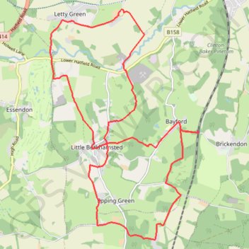
Interactive map
GPS track profile
About this GPS track
Name: Hertfordshire Chain Walk 3&4 GPS track, route, trail
Coordinates: 51.73612 -0.14352 51.78231 -0.09552
Topography: East Hertfordshire topographic map
Other GPS tracks
Click on a GPS track to view route, its statistics and profile.
2024-05-19_17-33_Sun
United Kingdom > England > Hertfordshire > North Hertfordshire > Royston
Distance: 44.8 mi • Elevation gain: 495 m • Maximum elevation: 114 m
2024-05-19_06-39_Sun
United Kingdom > England > London
Distance: 43.1 mi • Elevation gain: 480 m • Maximum elevation: 112 m