Clare Island
Randonnée pédestre. En aller simple. #Randonnée
- Distance: 9.0 mi
- Elevation gain: 636 m
- Maximum elevation: 455 m
- Elevation loss: 669 m
- Minimum elevation: 3 m
- Moving time: 3 h 40 m
- Moving speed: 2.5 mph
- Maximum speed: 4.1 mph
- Total time: 4 h 36 m
- Global speed: 2.0 mph
- Date: 05/07/10
Interactive map
GPS track profile
About this GPS track
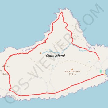
Name: Clare Island GPS track, route, trail
Coordinates: 53.79119 -10.02529 53.82692 -9.95283
Other GPS tracks
Click on a GPS track to view route, its statistics and profile.
RT5-1 Rosslare - Kinsale
Distance: 1,777.3 mi • Elevation gain: 27,381 m • Maximum elevation: 420 m
RT5-1 Rosslare - Kinsale
Distance: 2,402.9 mi • Elevation gain: 36,115 m • Maximum elevation: 524 m