Wilhelmina Falls
Murrindindi River Natural Features and Scenic Reserve. #Hike #Loop #Murrindindi
- Distance: 7.8 mi
- Elevation gain: 533 m
- Maximum elevation: 673 m
- Elevation loss: 533 m
- Minimum elevation: 324 m
Interactive map
GPS track profile
About this GPS track
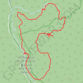
Name: Wilhelmina Falls GPS track, route, trail
Coordinates: -37.42404 145.56254 -37.39879 145.58249
Other GPS tracks
Click on a GPS track to view route, its statistics and profile.
Tallarook - Eildon - Hurstbridge
Australia > Victoria > Tallarook
#Bike
Distance: 173.2 mi • Elevation gain: 4,897 m • Maximum elevation: 868 m