Cabo de Gata to Castell de Ferro
- Distance: 81.0 mi
- Elevation gain: 3,349 m
- Maximum elevation: 284 m
- Elevation loss: 3,344 m
- Minimum elevation: 0 m
Interactive map
GPS track profile
About this GPS track
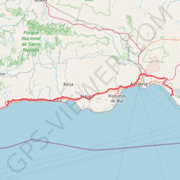
Name: Cabo de Gata to Castell de Ferro GPS track, route, trail
Coordinates: 36.72008 -3.36579 36.89332 -2.22532
Other GPS tracks
Click on a GPS track to view route, its statistics and profile.
Southern Section — European Divide Trail
Espagne > Andalousie > Cazorla
Distance: 516.0 mi • Elevation gain: 19,253 m • Maximum elevation: 2,134 m
Vila do Bispo -> Distrito 4 (495,2 km)
Distance: 811.8 mi • Elevation gain: 23,128 m • Maximum elevation: 2,134 m
Calar_Alto_W2220
Espagne > Andalousie > Níjar > Ruescas
Distance: 49.8 mi • Elevation gain: 2,615 m • Maximum elevation: 2,166 m