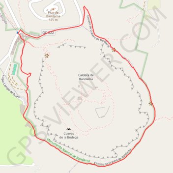
Monumento Natural de Bandama
- Distance: 2.2 mi
- Elevation gain: 219 m
- Maximum elevation: 480 m
- Elevation loss: 219 m
- Minimum elevation: 374 m
Interactive map
GPS track profile
About this GPS track
Name: Monumento Natural de Bandama GPS track, route, trail
Start: GC-822, Los Hoyos, Santa Brígida, Las Palmas, Îles Canaries, 35229, Espagne (28.03563 -15.45991)
End: GC-822, Los Hoyos, Santa Brígida, Las Palmas, Îles Canaries, 35229, Espagne (28.03562 -15.45990)
Coordinates: 28.02786 -15.46028 28.03767 -15.45076
Other GPS tracks
Click on a GPS track to view route, its statistics and profile.
TGCC 2024 10.07.2023
Espagne > Las Palmas de Grande Canarie
Distance: 79.6 mi • Elevation gain: 7,197 m • Maximum elevation: 1,746 m