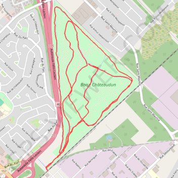
Tour du Boisé Châteaudun
Interactive map
GPS track profile
About this GPS track
Name: Tour du Boisé Châteaudun GPS track, route, trail
Start: 830, Rue Saint-Laurent, Trois-Rivières, Mauricie, Québec, G8T 2H1, Canada (46.38110 -72.53820)
End: 830, Rue Saint-Laurent, Trois-Rivières, Mauricie, Québec, G8T 2H1, Canada (46.38113 -72.53822)
Coordinates: 46.38084 -72.53832 46.39742 -72.52569
Other GPS tracks
Click on a GPS track to view route, its statistics and profile.
Trois-Rivières - Québec
Canada > Quebec > Trois-Rivières
#Bike
Distance: 86.0 mi • Elevation gain: 838 m • Maximum elevation: 108 m
Trois-Rivières - Portneuf
Canada > Quebec > Trois-Rivières
Saint Lawrence River. #Bike #TroisRivières #Portneuf #SaintLawrence
Distance: 42.0 mi • Elevation gain: 211 m • Maximum elevation: 44 m