Cracovie (Pologne) promenade au quartier juif
Interactive map
GPS track profile
About this GPS track
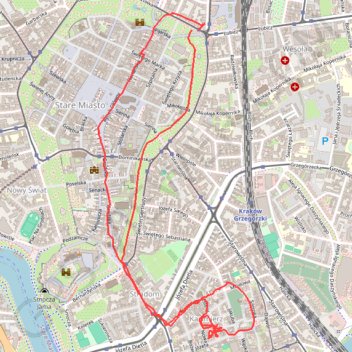
Name: Cracovie (Pologne) promenade au quartier juif GPS track, route, trail
Coordinates: 50.05092 19.93744 50.06551 19.94833
Other GPS tracks
Click on a GPS track to view route, its statistics and profile.
Tour d'Europe
France > Bretagne > Finistère > Concarneau > Landan Creis
Distance: 4,432.2 mi • Elevation gain: 44,603 m • Maximum elevation: 2,433 m