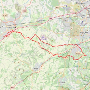
Brighton Hill - South Downs National Park
MTB loop from Brighton Hill to South Downs National Park via Upton Grey, Long Sutton, Farnham, Tilford, Holt Pound, Lodge Inclosure, Bentley, Lower Froyle and South Warnborough. #MTB #Loop #Nature #Countryside #Forest
- Distance: 42.4 mi
- Elevation gain: 914 m
- Maximum elevation: 183 m
- Elevation loss: 913 m
- Minimum elevation: 51 m
- Moving time: 3 h 47 m
- Moving speed: 11.2 mph
- Maximum speed: 33.1 mph
- Total time: 4 h 48 m
- Global speed: 8.8 mph
- Date: 31/08/14
Interactive map
GPS track profile
About this GPS track
Name: Brighton Hill - South Downs National Park GPS track, route, trail
Coordinates: 51.17294 -1.12113 51.25420 -0.75143
Topography: Basingstoke and Deane topographic map