Trail Planner Map
- Distance: 4.9 mi
- Elevation gain: 243 m
- Maximum elevation: 630 m
- Elevation loss: 243 m
- Minimum elevation: 534 m
Interactive map
GPS track profile
About this GPS track
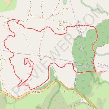
Name: Trail Planner Map GPS track, route, trail
Coordinates: 38.72525 -27.23666 38.73621 -27.21654
Other GPS tracks
Click on a GPS track to view route, its statistics and profile.
Grande Rota do Oeste - BTT (Ilha Terceira)
Distance: 38.1 mi • Elevation gain: 1,957 m • Maximum elevation: 779 m
PRC06 TER - Rocha do Chambre
Distance: 13.9 mi • Elevation gain: 783 m • Maximum elevation: 699 m