Toohey Forest Conservation Park
Interactive map
GPS track profile
About this GPS track
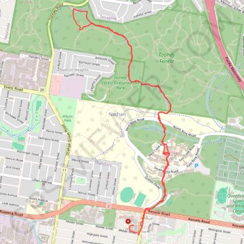
Name: Toohey Forest Conservation Park GPS track, route, trail
Start: Middle Street, Coopers Plains, Greater Brisbane, Queensland, 4108, Australia (-27.56031 153.04950)
End: 189, Middle Street, Coopers Plains, Brisbane City, Queensland, 4108, Australia (-27.56103 153.05004)
Coordinates: -27.56132 153.04218 -27.53716 153.05401
Other GPS tracks
Click on a GPS track to view route, its statistics and profile.