Cam Peak
- Distance: 8.1 mi
- Elevation gain: 400 m
- Maximum elevation: 242 m
- Elevation loss: 387 m
- Minimum elevation: 95 m
- Moving time: 2 h 50 m
- Moving speed: 2.9 mph
- Maximum speed: 9.3 mph
- Total time: 3 h 26 m
- Global speed: 2.4 mph
- Date: 21/04/24
Interactive map
GPS track profile
About this GPS track
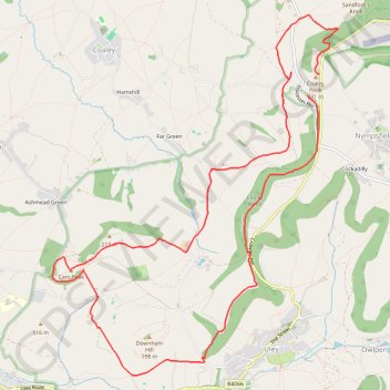
Name: Cam Peak GPS track, route, trail
Coordinates: 51.68055 -2.34004 51.71517 -2.29583
Topography: Gloucestershire topographic map
Other GPS tracks
Click on a GPS track to view route, its statistics and profile.
Dean2023-311
United Kingdom > England > Oxfordshire > Oxford
Distance: 192.8 mi • Elevation gain: 3,366 m • Maximum elevation: 290 m