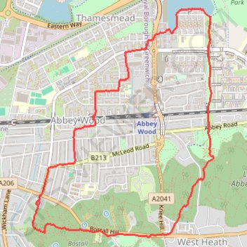
Wogebourne Lost River and Woods Loop
Loop hike along the Wogebourne River (underground), Bostall Woods, Lesnes Abbey Woods, Abbey Way and Southmere. #Hike #Loop #River #Nature #Forest #Park #Lake
- Distance: 4.3 mi
- Elevation gain: 79 m
- Maximum elevation: 67 m
- Elevation loss: 81 m
- Minimum elevation: -1 m
- Moving time: 1 h 29 m
- Moving speed: 2.9 mph
- Maximum speed: 4.2 mph
- Total time: 1 h 30 m
- Global speed: 2.9 mph
- Date: 05/02/24
Interactive map
GPS track profile
About this GPS track
Name: Wogebourne Lost River and Woods Loop GPS track, route, trail
Coordinates: 51.48125 0.10545 51.49961 0.12886
Topography: London topographic map
Other GPS tracks
Click on a GPS track to view route, its statistics and profile.
Crossway Park
United Kingdom > England > London
Morning Run
Distance: 5.9 mi • Elevation gain: 37 m • Maximum elevation: 23 m
Woolwich Common
United Kingdom > England > London
Morning Walk
Distance: 7.1 mi • Elevation gain: 134 m • Maximum elevation: 66 m
Crossway Park
United Kingdom > England > London
Morning Run
Distance: 6.0 mi • Elevation gain: 38 m • Maximum elevation: 22 m
Lesnes Abbey Woods
United Kingdom > England > London
Morning Walk
Distance: 3.8 mi • Elevation gain: 103 m • Maximum elevation: 68 m
Lesnes Abbey Park
United Kingdom > England > London
Morning Walk
Distance: 4.2 mi • Elevation gain: 88 m • Maximum elevation: 73 m
Thamesmead
United Kingdom > England > London
Morning Run
Distance: 4.2 mi • Elevation gain: 24 m • Maximum elevation: 21 m
Newhaven Londres
Royaume-Uni > Angleterre > Cité de Londres
Vélo. En aller simple entre Londres et Newhaven. #Vélo
Distance: 96.7 mi • Elevation gain: 1,139 m • Maximum elevation: 202 m